6. The study and development of a system to monitor and assess the quantity of greenhouse gases from land use by remote sensing technology
(2017-2019)
Position Held: Spatial Data Analyst
Location: Thailand (Chiang Mai, Chai Nat, Nakhon Ratchasima, Ratchaburi, Chon Buri, Chachoengsao, Rayong, Nakhon Pathom, Surin, Sukhothai, Kanchanaburi, Khon Kaen and Phrae, Nan)
Client: Thailand Greenhouse Gas Management Organization (TGO)
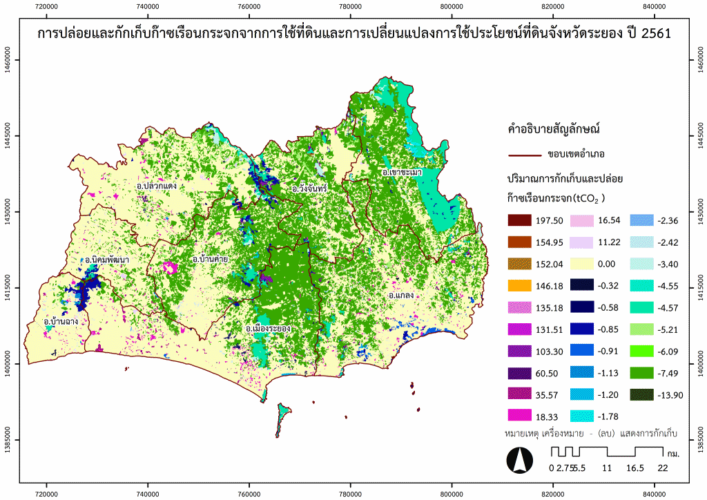
Main Project Features: Develop a system to track land use and land-use change at the provincial level by categorizing land-use types from satellite imagery at various time periods according to the GPC and 2006 IPCC guidelines. Then, calculate greenhouse gas emissions and removals from activities carried out in each area to provide data to support the development of provincial-level greenhouse gas reduction strategies and to assess the resulting impacts.
Main Duties: (i) Interpret and verify the accuracy of the interpretation of land-use types from satellite imagery. (ii) Analyze annual changes in land use. (iii) Survey the field to collect actual data on land use in the present time, as supporting information for interpreting and verifying the accuracy of land use interpretation from satellite imagery.


Map of land use in Rayong Province from 2017 to 2020, interpreted from satellite imagery
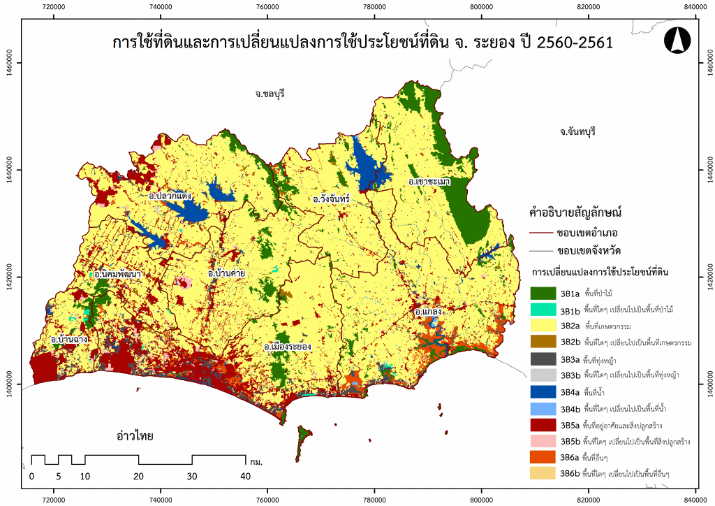
The map of land use changes in Rayong province between 2017-2020